Ranges and drainage
Whole-world terrain models that turn vague mountain belts into connected ranges and keep drainage organised.
What it does#
A planet map at several kilometres per pixel knows where its mountains are and little else. A range is a few pixels wide, too coarse to hold its ridges and valleys, and the rivers a render routes across it wander, because nothing in the terrain tells the water where the valleys are.
Two terrain models trained on Earth relief redraw a whole planet's terrain from your map: the Ranges and drainage pass, then the local detail pass. Mountain belts come back as connected ranges with ridgelines you can follow for a hundred kilometres or more. Valleys form where the rivers run, so the drainage stays organised from the continental divide down to the valley floor. Your map still decides where the land, the high ground and the basins are.
The Ranges and drainage pass lays out the ranges and the drainage over the whole planet. The local detail pass then adds smaller features on top of it.
The Ranges and drainage pass#
The Ranges and drainage pass runs at about 4.72 km per pixel over the whole planet. In the Whole-world passes dialog it is the Ranges and drainage option under Enhance world terrain.
Before the model runs, rivers are routed across your active heightmap, and the model uses that river network as a guide for where valleys belong. The rivers always come from the heightmap itself. The pass takes no separate river map or climate map.
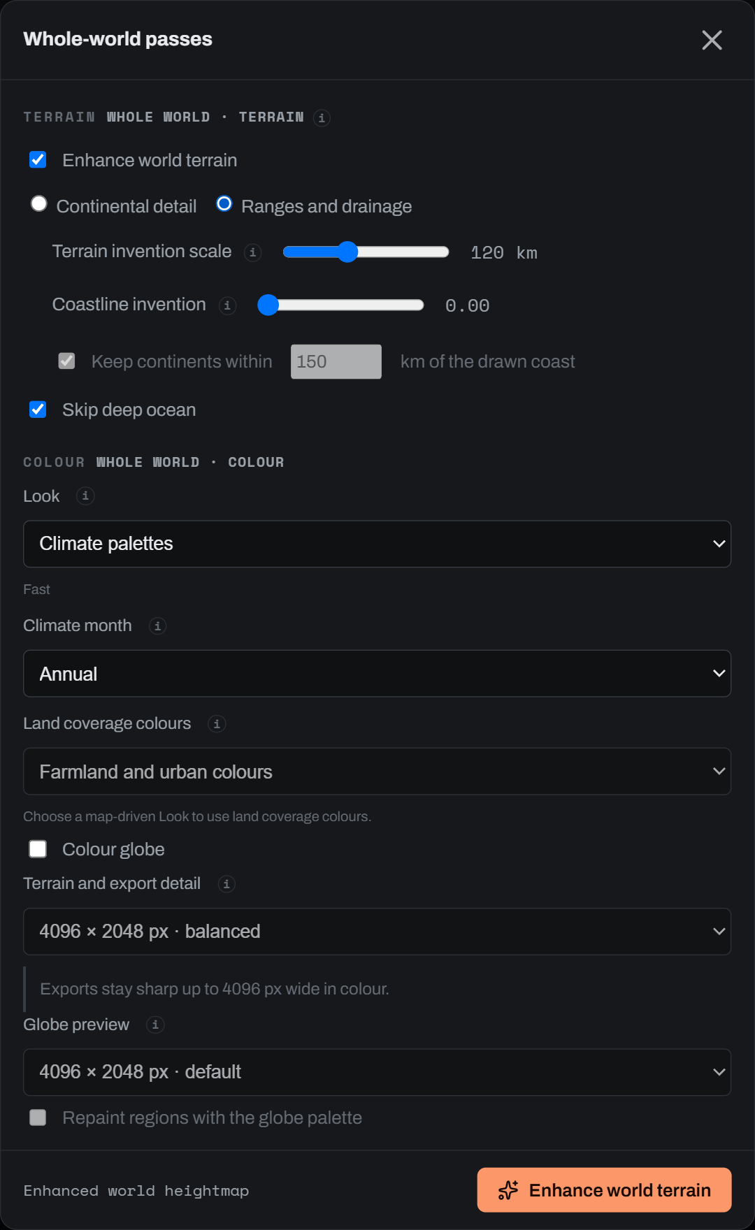
Its dials:
| Control | Default | Range | What it does |
|---|---|---|---|
| Terrain invention scale | 120 km | 15 to 300 km | Your map is trusted above this scale, and the model invents ranges and valleys below it. 30 km hugs your map closely; 300 km keeps only the continent-scale shape. |
| Coastline invention | 0 | 0 to 1 | 0 keeps the coastline you drew exactly. Higher values let the model redraw it from the bathymetry: smooth on steep margins, intricate on shallow shelves. Above about 0.5 the land mask changes, so climate, rivers and biomes are recomputed from the new terrain. |
| Keep continents within | 150 km | 10 to 2000 km | Only when Coastline invention is above 0. Limits how far a redrawn coast may move from the one you drew. |
| Skip deep ocean | on | on, off | Deep-ocean areas keep their authored bathymetry instead of being sampled, which saves most of the runtime on an ocean world. |
The pass scales with your planet's radius, so a smaller world gets ranges of the same ground size on a smaller sphere.
Polar caps above 60° of latitude are an extrapolation: the model sees far less terrain like them, so expect them to read less convincingly than the mid-latitudes.
A whole Earth-size planet took about 20 minutes on an RTX 5090.
The local detail pass#
The local detail pass runs at about 1.18 km per pixel. It adds the spurs, gullies and side valleys below about 20 km, and keeps everything larger from the Ranges and drainage pass, so the ranges and the drainage it was handed stay where they were.
A whole Earth-size planet took about 6 hours on an RTX 5090. Above 72° of latitude the output is the Ranges and drainage terrain, unchanged.
On held-out test regions, the local detail pass kept fine relief at 0.96× to 0.98× of real terrain in mountain and coastal ground. Large rivers followed valley floors 74 % of the time, against 78 % on real terrain.
What to expect#
These models are good at structure. They are not finished, and these limits show up today:
- Flat lowlands carry a slight grain.
- Small closed pits appear here and there.
- Occasional isolated spikes stand up out of otherwise smooth ground.
- Flat shelves route water as broad fans rather than single channels.
- Drainage is not guaranteed to connect. Most large rivers find a continuous valley, but some break.
How it was checked#
The Ranges and drainage pass was scored on a small set of held-out test regions: Earth terrain the model never saw during training, compared like for like with the real relief of the same regions.
| Measure | Model | Real terrain |
|---|---|---|
| Large rivers lying on a valley floor | 97 % | 96 % (random land: 54 %) |
| Average unbroken ridge length | 110 to 142 km | 131 km |
| Relief in each scale band | 0.7× to 1.5× of real | 1× |
The test set is small. The numbers say the ranges are connected and the rivers sit in valleys at about the rate real terrain manages. They do not say every region will look right.