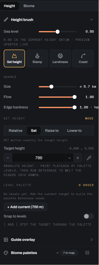
HEIGHT
Absolute metres
Set, raise or lower to an exact elevation. Block in flat levels and Deterrace melts the risers between them into slopes.
Dayside is a desktop app for rendering an invented planet the way a mapping satellite would see it. You rough the world in, cut out the regions you care about, and render those with proper relief, drainage, snow and biome colour, all at measured scale. Finished regions go back onto the globe, and the globe exports.
Each of these is a painted heightfield and a climate map, put through the render pass once. Nothing was touched up afterwards. The captions give the section extents so you can judge the scale for yourself.
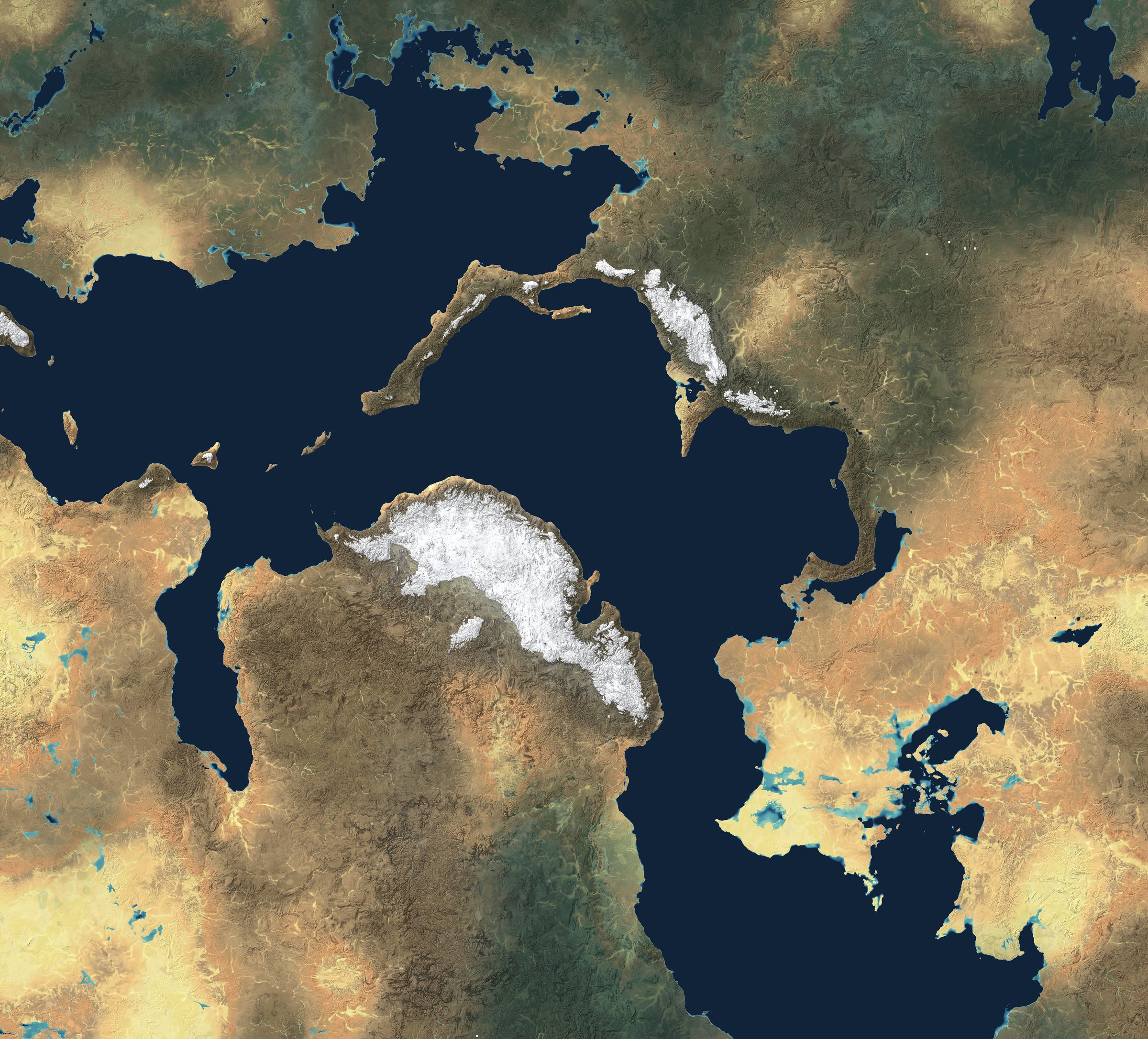
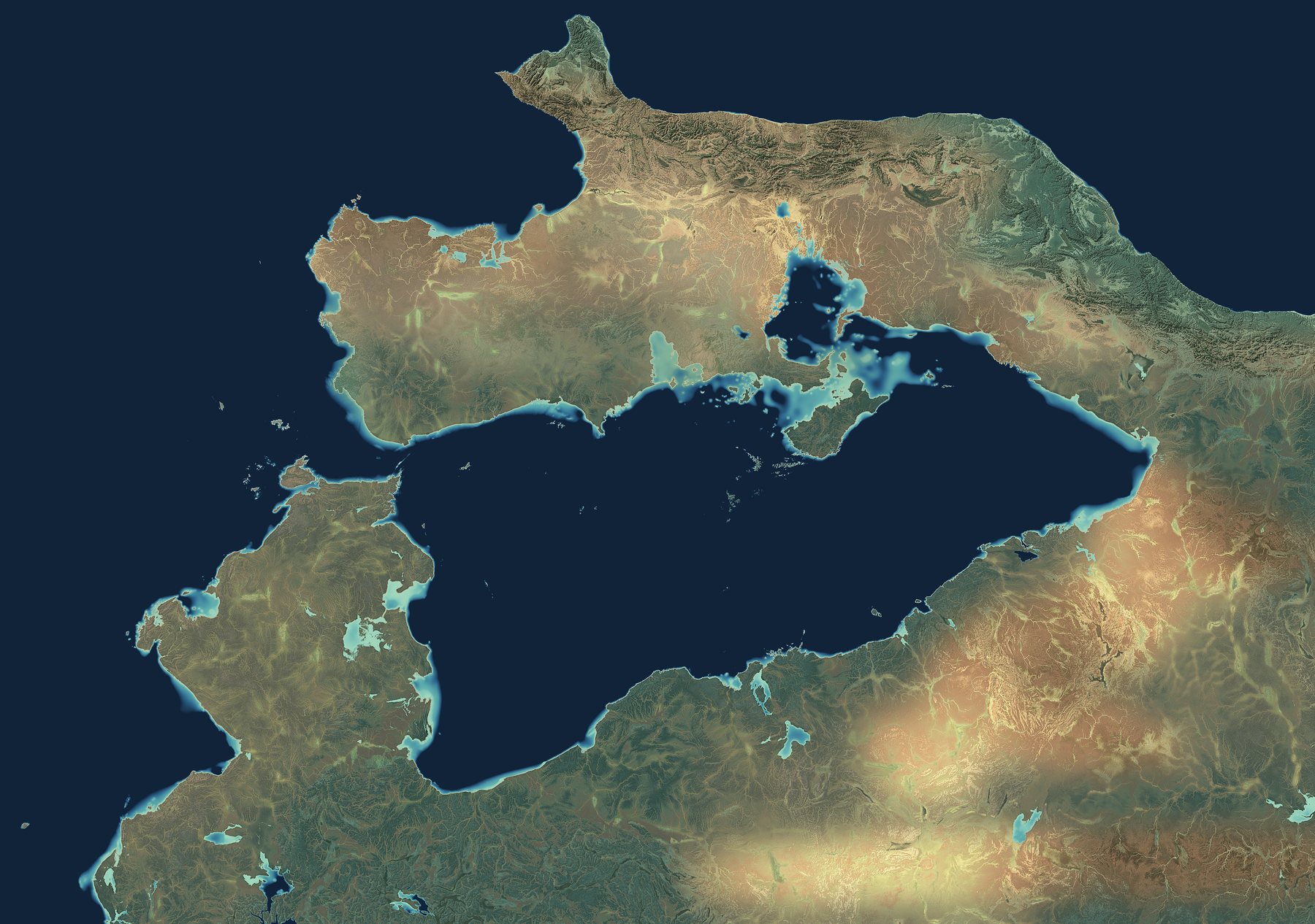
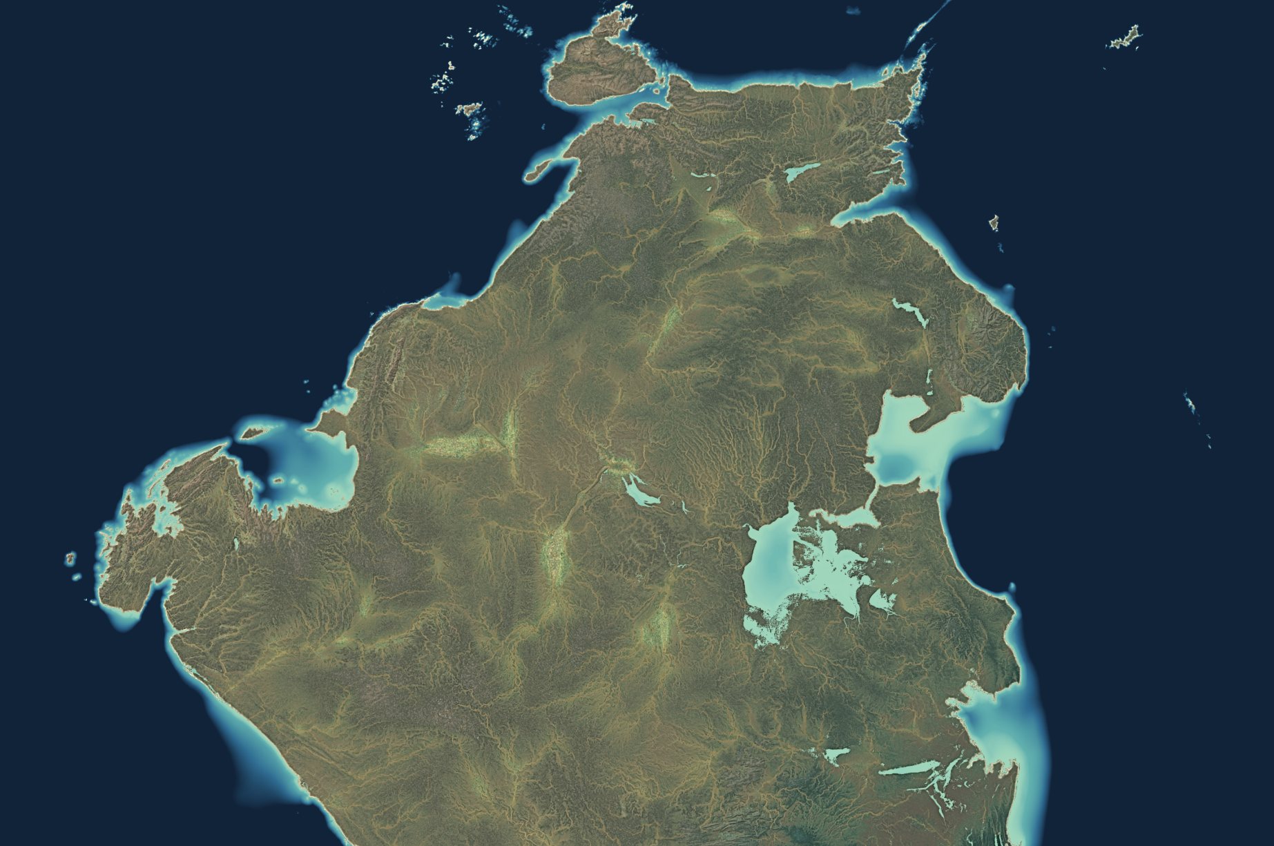
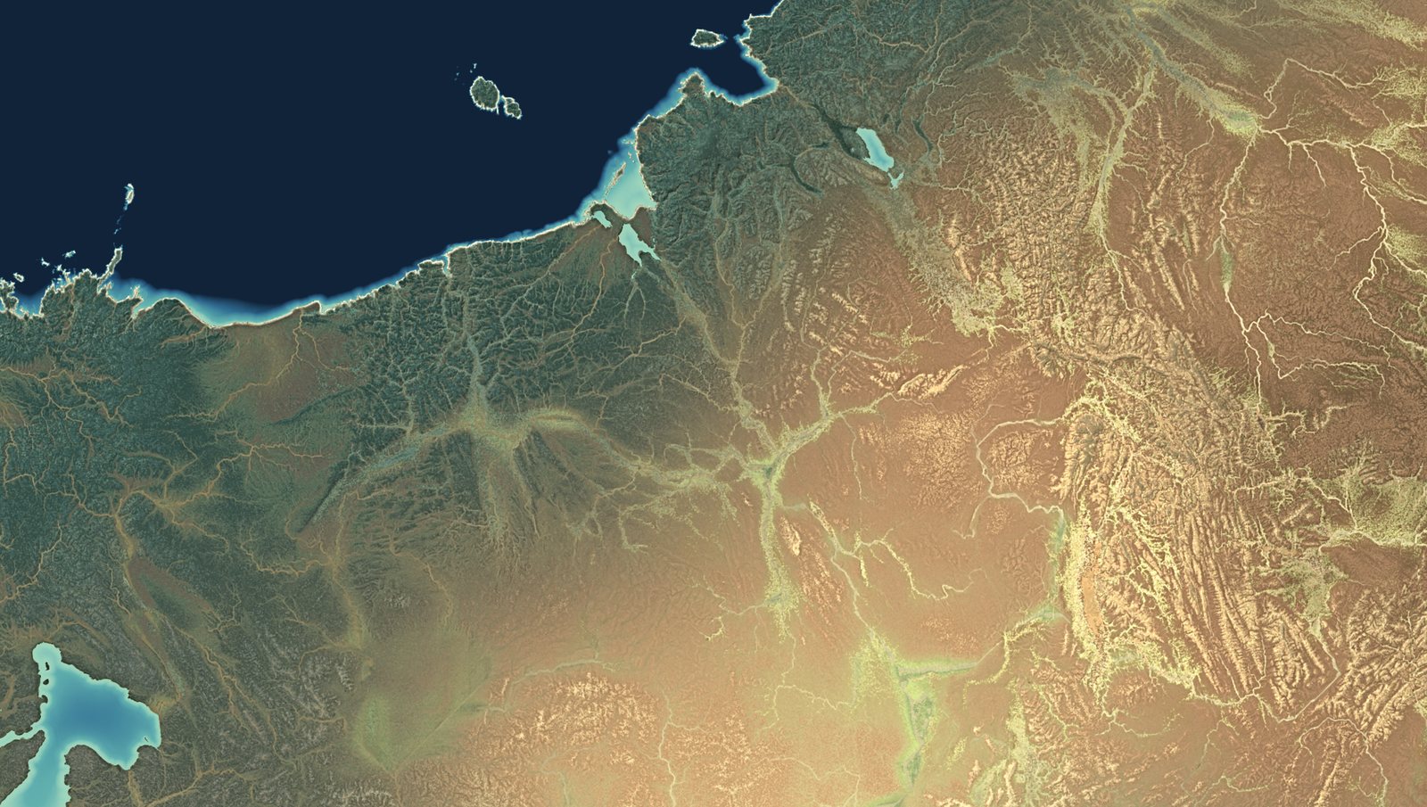
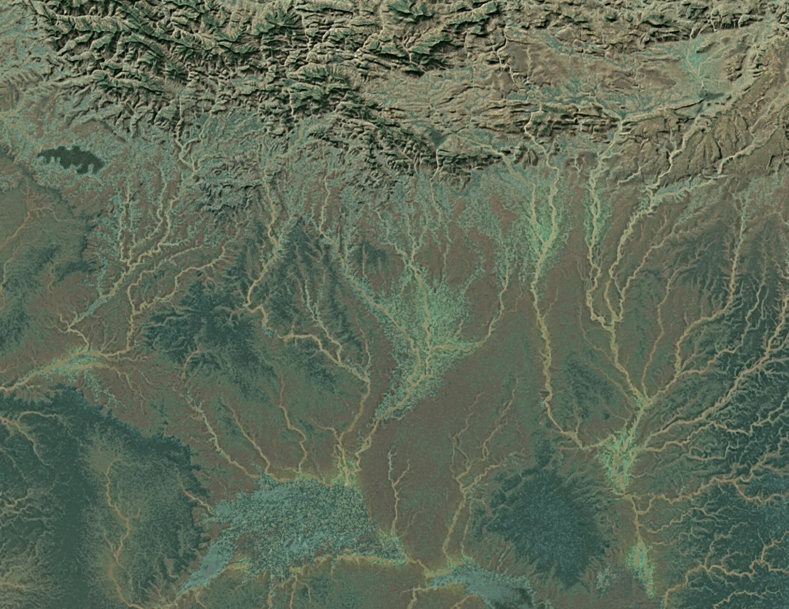
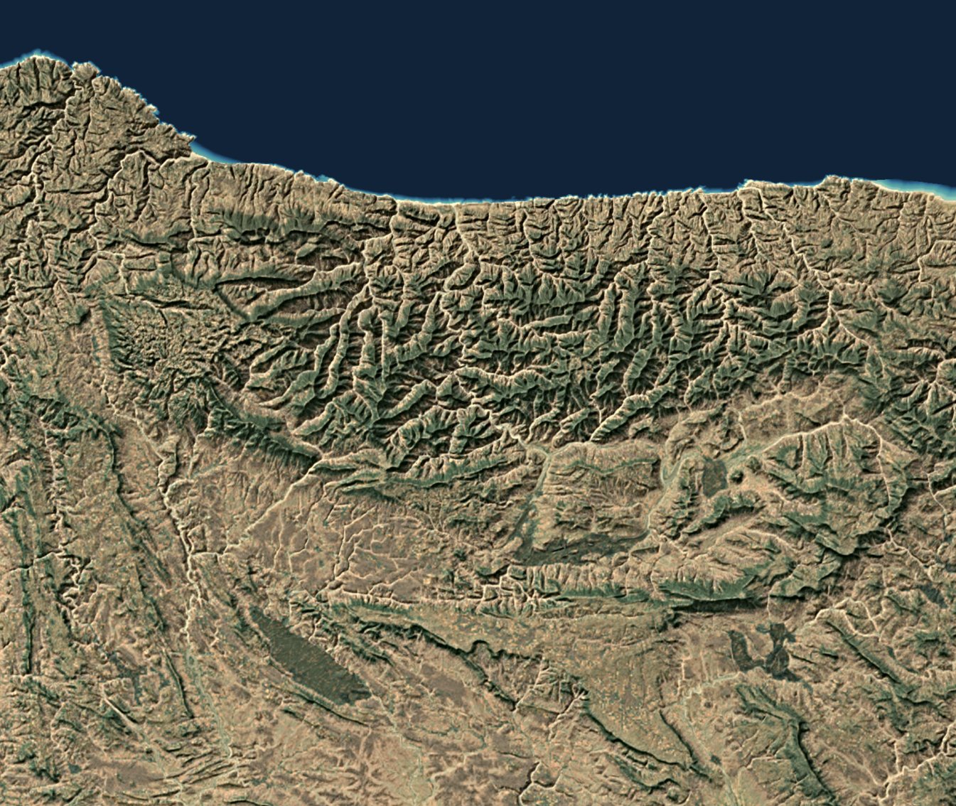
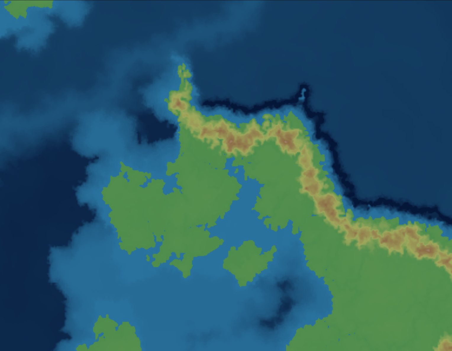
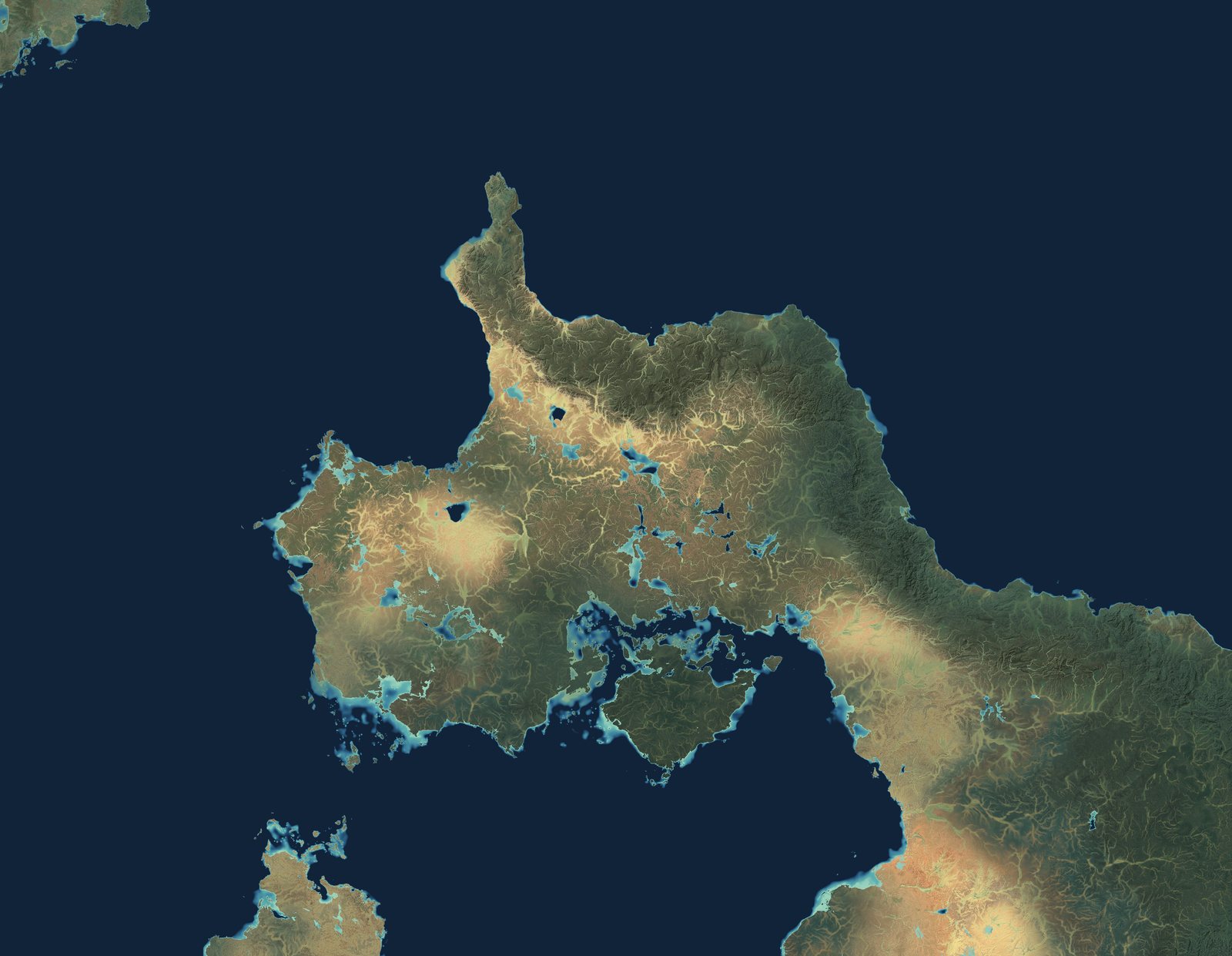
Drag to compare. The left half is the flat height bands as they were blocked in by hand. The right is the same section after synthesis and colour. The colour is computed from slope, elevation, drainage and the painted climate, which is why it still makes sense when you zoom from the whole section down into one valley.
You never render the whole planet at full detail, because you don't need to. Pick a region, cut it out as a low-distortion section, work on that, and put it back. The globe keeps track of which sections are current and which have gone stale.
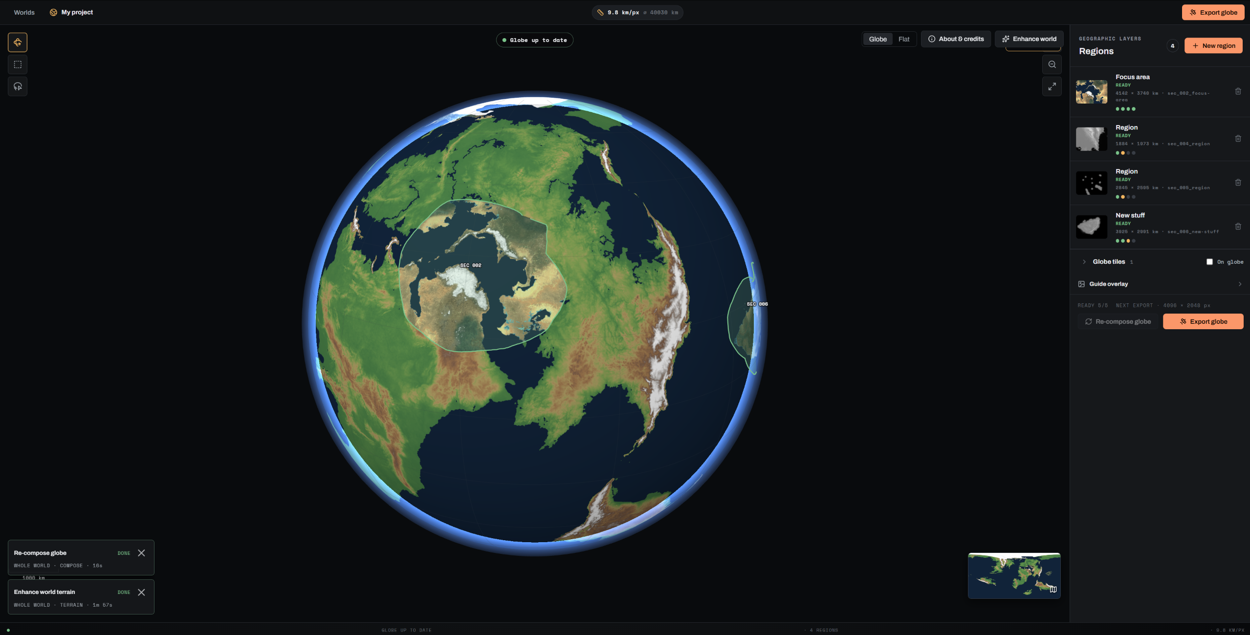
STEP 1 · AUTHOR THE PLANET
Import an equirectangular heightmap, or start with an empty globe and draw the continents straight onto it. Latitude gives every part of the planet a first-guess climate, and you paint over that wherever you know better. The render pass works out the rain shadow behind your ranges on its own. Then mark the regions you want to survey.
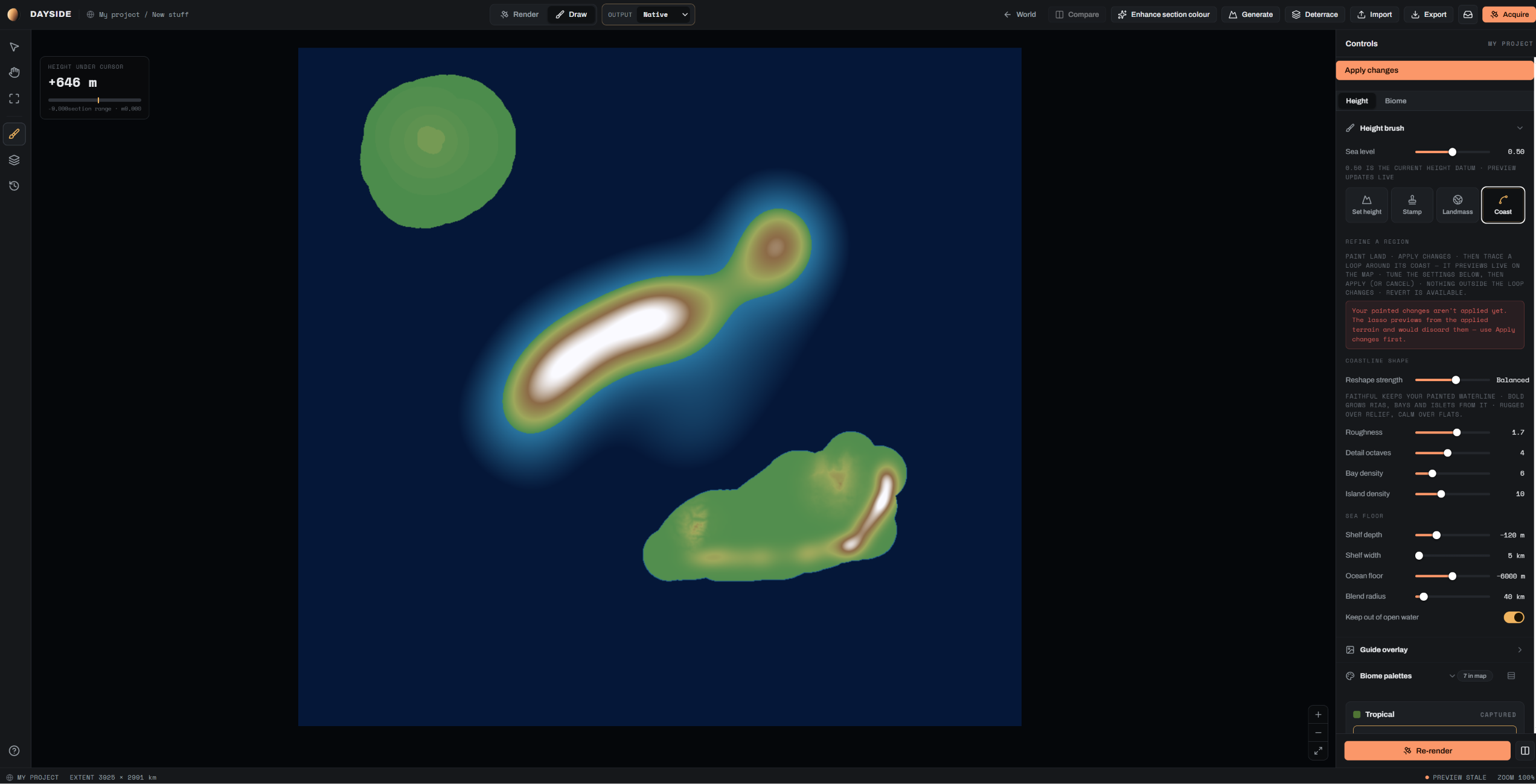
STEP 2 · DRAW THE GROUND
Every brush is scaled to the ground, so a 33 km coast brush is 33 km on any section. There's a library of 55 landforms measured off real ground to stamp down, fold belts and rifts and volcanic fields at the widths they really have. Plateau heights are typed in as metres. Trace a coastline and the coast tool grows rias, bays and islets out of your line without losing the line.
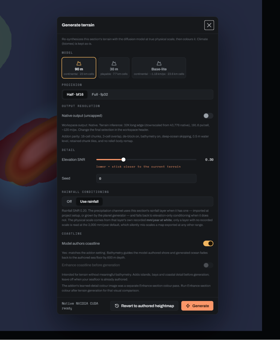
STEP 3 · SYNTHESISE & EXPORT
Synthesis re-cuts the section at whatever pixel size you ask for, using your painted heights, your rainfall and your coastline as the guide. 90 m per pixel covers a continent. 30 m is close enough to walk on. Colour is rendered on top, and the finished section goes back onto the globe.
Exports are 16-bit heightmaps, colour plates and globe tiles up to 32K, in formats Blender and Unreal read without conversion.
Most of the work happens in four panels. Every slider reads in a real unit, metres or kilometres or degrees, and each panel says what it's about to change before you commit.
HEIGHT
Set, raise or lower to an exact elevation. Block in flat levels and Deterrace melts the risers between them into slopes.
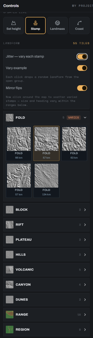
LANDFORM
Fold belts, rifts, plateaus, canyons, dunes, cut from real elevation data at their true widths. Turn on jitter and each click drops a different one, resized and mirrored.
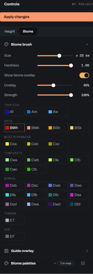
CLIMATE
Paint any class from Af to EF straight onto the map. Wherever you've painted, that wins over the latitude guess.
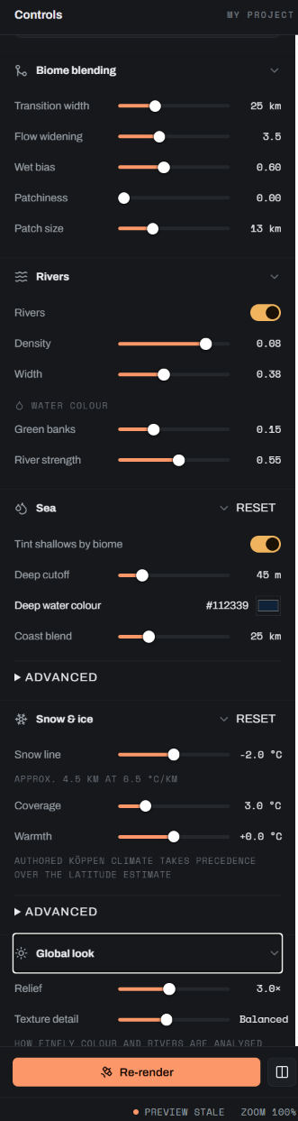
RENDER
Snow line as a temperature and a lapse rate, deep-water colour as a hex value, river density and width. Changes show in the preview as you drag.
COASTLINE LIBRARY
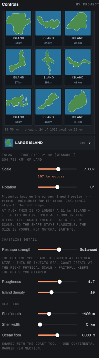
Every outline is a real island, from skerries under 3 km to landmasses over 50 km across. Stamp a 21 km island at 7.6× and you get a 157 km landmass that still reads as a coast, because the fine coastal detail is put back in at the size you placed it rather than stretched along with the outline.
Dayside does the planet-scale part. Where another tool does a job better, it hands the file over and takes it back afterwards. You can come in at any of these three stages and leave at any of them.
STAGE 1 · GET A WORLD
Simulate a planet in one of these and import its heightmap and climate layers. If you're starting a new world from nothing, this is the fastest way in.
Or start with an empty globe or a flat map, load your own sketch as a guide overlay, and trace it.
STAGE 2 · ENHANCE SECTIONS
Cut sections out of the globe, synthesise them at the pixel size you need, paint the climate and render the colour.
If you'd rather do the erosion in Gaea or Wilbur, export the section as a 16-bit heightfield, work on it there and bring it back. The metre range and the extents survive the trip.
STAGE 3 · REASSEMBLE
Put every finished section back on the sphere and export the whole world as globe tiles up to 32K, colour plates and 16-bit heightmaps.
There's a Blender add-on that loads the tiles onto a displaced sphere with the colour already lined up, so all that's left is lighting it.
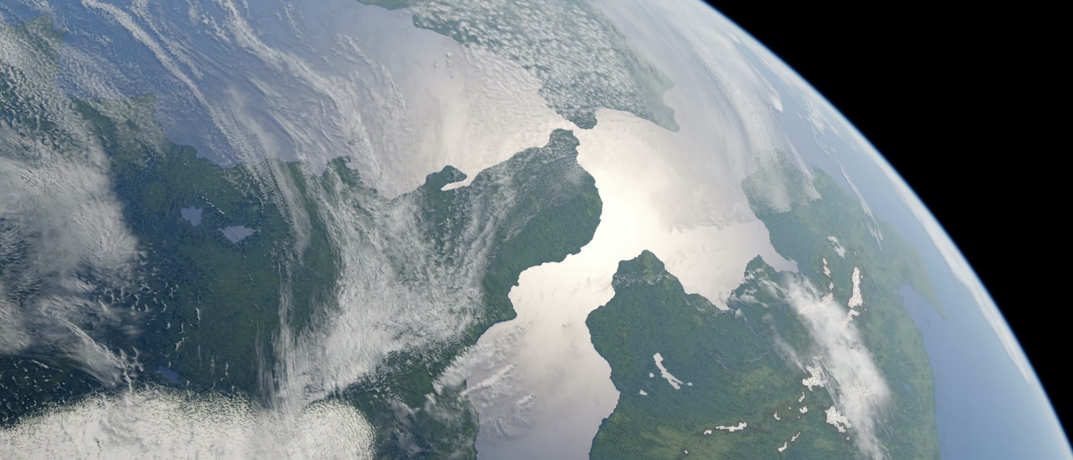
BLENDER · CYCLES · 32K TILES
Straight from the exporter into Cycles: the tiles displaced onto a sphere, one sun lamp, and nothing else done to it.
There's no subscription and nothing renders in the cloud. It runs on your own machine, offline if you want, and it keeps working after you've paid for it. These are the tiers. Prices are announced when early access opens, and the waitlist hears them first.
Free
NON-COMMERCIAL
The complete app, for personal work. Learn it on real projects and share what you make.
Indie
ONE-TIME LICENCE
For one person and anything you make yourself, commercial or not, up to $100K a year in revenue.
Professional
ONE-TIME LICENCE
Everything the engine can produce, for individuals and teams up to $1M a year.
Studio
ONE-TIME LICENCE
For studios and anything with a legal department.
REVENUE BANDS SELF-ATTESTED AT CHECKOUT · PRICES ANNOUNCED WHEN EARLY ACCESS OPENS
SYSTEM REQUIREMENTS
EARLY ACCESS
The private beta goes out in small batches, and the earliest go to the people who say what they're working on.
One more step: a confirmation mail is on its way. Click the link in it and you're on the list.
NO OPEN TRACKING · UNSUBSCRIBE ANY TIME · PRIVACY
A diffusion model trained on public elevation data, meaning SRTM, Copernicus and the other government DEM archives. It has never seen an artist's heightmap, so there's no other person's work in it. It runs on your own GPU and nothing leaves your machine. The nearest comparison is an erosion solver, except it has seen a great deal more real ground than any erosion solver has.
Yes. On every paid licence the images and heightmaps are yours to use commercially, print and sell. The free tier is for non-commercial work only. If you're on Studio you get the ownership terms as a signed document, because that is what a legal department will ask you for.
Alongside them. Gleba and Rock 3 simulate a planet, which is a good place to start from, and Dayside imports what they produce. Gaea and Wilbur are better than Dayside at working a single terrain, so Dayside round-trips 16-bit heightfields to them. What neither pair does is the bit in between: cutting a globe into sections you can work on without projection distortion, painting climate and coastlines, synthesising at real scale, and putting the pieces back on the sphere. That's what this is for.
That's the usual starting point. Load it as a guide overlay, trace the coast, block in the ranges with stamps, paint the climate and render. The coastline tool adds detail to your line but it keeps your line, so the shapes you drew are the shapes you get.
On a mid-range card, a continental section at 90 m per pixel takes a couple of minutes. Colour re-renders in seconds and previews as you drag. Rebuilding the whole globe from finished sections is about fifteen seconds.
Not at launch. Synthesis runs on CUDA only for now, so it's Windows and an NVIDIA card. Mac and AMD are both on the list. If you're on one of them, join the waitlist and say so. That's what decides which comes first.
Dayside started as a side project on a worldbuilding channel, out of one recurring question: why fictional maps never look like the real thing from orbit. The answer, every time, was scale. A mountain range drawn at twice its real width looks fake even when you can't say why. So every brush, stamp and slider in the app is in real units. Get the metres right and most of the rest follows.
Every build gets a video going through what changed and why.